Cohasset

Home / Cohasset

TRAIL LISTING

We've combed the internet and maps to pull this list together. Don't see your favorite? Tell us via the live chat.

REVIEWS

South Shore Quest 2020

Are you looking for a way to engage the whole family? Or just challenge yourself on a hike? You should ...
Brass Kettle / Cohasset

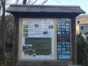
Brass Kettle Conservation trails are located off King Street in Cohasset. The land was officially acquired by the town of ...
Turkey Hill / Hingham

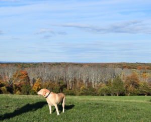
Turkey Hill is a 62 acre piece of land that is managed by the Trustees of the Reservation in partnership ...
Whitney Thayer Woods - Cohasset - Trustees

Whitney Thayer Woods / Cohasset

Whitney Thayer Woods is an 824 acre Trustees property located in Cohasset along 3A. The trail network consists of approximately 10 ...

Sumner Smith Overlook / Cohasset

Sumner Smith Overlook is a very small trail with an incredible view. Located on Cohasset Harbor, the overlook gives you ...

Pape Reservation Cohasset

Pape Reservation / Cohasset

Pape Reservation is a 10 acre piece of land located off 3A in Cohasset. The conservation area is accessible from the ...

Loading...

LANDSCAPE

The town of Cohasset is a coastal town that is about 25 miles south of Boston. It is bordered by Scituate, Hingham and Hull. The shore is rocky, with many small ledges and rocks lying offshore. Cohasset Cove and The Gulf provide a long portion of the border with Scituate, while Straits Pond divides Cohasset from neighboring Hull. Near the center of the coast lies Little Harbor, a large inlet divided from the ocean by Beach Island. Several other brooks and rivers run through the town. A large portion of the southwestern part of town is occupied by the Wompatuck State Park (formerly the Hingham Naval Ammunition Depot Annex), and the Whitney & Thayer Woods Reservation. There is also a bird sanctuary, as well as a large park (Wheelwright Park) near Little Harbor. There are three beaches along the bay, and the Cohasset Yacht Club, Cohasset Sailing Club and a public boat launch in Cohasset Harbor.

Total Area: 31.5 sq. miles
Land Area: 9.9 sq. miles
Population: 7,542
Density: 762 per sq. mile

(source: Cohasset Wikipedia Page)

CONSERVATION

Cohasset has done an incredible job preserving the town's natural resources. The Cohasset Conservation Commission is responsible for the protection and management of Cohasset's Conservation land and for the administration of the Massachusetts Wetlands Protection Act and related town bylaws.

Conservation land in Cohasset comes from many sources including: (1) Town resources (2) Cohasset Conservation Trust and (3) The Trustees of the Reservation. For each trail included in our database, we've listed the agency responsible for maintaining and preserving the resource.

HISTORY

Cohasset was first seen by Europeans in 1614 but not settled until 1670. It was originally part of Hingham, known as Hingham's Second Parish, however separated in 1770. The town's name came from the Algonquian word "Conahasset", meaning "long rocky place" which is incredibly accurate if you take a drive along the coast.

The shipbuilding and fishing industries expanded in the early 1880s from being primarily agricultural. However, while the 1970s saw some decline in the maritime industry this was also when many affluent and famous Bostonians discovered the coast. The new town wealth began to summer here and build large coastal estates. The 1930s and 1940s saw the large summer estates being transformed to year around residences. By the 1950s Cohasset had become increasingly suburban with many residents commuting to Boston. The 1960 census indicated that population jumped 56% over the prior decade.