The town of Pembroke has a total area of 23.5 square miles, of which 21.8 square miles is land and 1.6 square miles, or 6.95%, is water. Statistically, Pembroke is slightly smaller than the state average in terms of land area. Pembroke is bordered by Norwell to the north, Marshfield to the northeast, Duxbury to the east, Kingston to the southeast, Plympton to the south, Halifax to the southwest, Hanson to the west, and Hanover to the northwest. Pembroke is approximately 27 miles southeast of Boston.
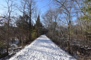
Pembroke's geography can be divided in half. The northern half is dominated by the rivers and streams of the area, flowing through thick forests which once provided the lumber for the North River's shipbuilding industry. The southern half is dominated by several ponds and Silver Lake, where the towns of Pembroke, Kingston, Plympton and Halifax come together. The town has its own municipal forest, which is divided into sections around town.
Total Area: 23.5 sq. miles
Land Area: 21.8 sq. miles
Population: 17,837
Density: 760 per sq. mile
(source: Pembroke Wikipedia Page)
Most notable of the town's resources are its water resources, which include the North River and Indian Head River; its ponds, Oldham, Furnace, Great Sandy Bottom, Little Sandy Bottom, and Stetson Ponds; and Silver Lake. The town's ponds, streams and marshes are the home of herring that were prized so much that in 1741, the town began regulating the taking and preservation of the fish. The herring are celebrated each year at the town's annual "Grande Old Fish Fry".
(source: Pembroke Wikipedia Page)
The earliest European settlers were Robert Barker and Dolor Davis, who settled in the vicinity of Herring Brook in 1650. Up until that time, the Wampanoag and the Massachusett were the only residents, fishing and farming along the rivers; they called the area Mattakeesett, which means "place of much fish", because of the annual springtime run of herring in the local rivers. The land was part of the Major's Purchase, a large tract of lands bought from Josias Wampatuck of the Massachusetts by a group of English investors. The area was once a part of Duxbury, before incorporating as a separate town in 1712, and was ultimately named for the town of Pembroke, Wales.
The town has large tracts of woodlands that provided timber for homes and industry, and provided cover for abundant wildlife. Because of its proximity to timber and location on the river, the town in its early years was known for its shipbuilding industry. The North River was the location of five shipyards – Brick Kiln Yard, Seabury Point, Job's Landing, Turner's Yard and Macy's. Between 1678 and 1871, 1,025 vessels were produced on the shores of the North River.
The town took its current form in 1820, when the western half of town known as the "West Parish" was separated and incorporated as Hanson. Shipbuilding was among the area's industries, with five yards along the North River. Famous among these were the Beaver, a vessel made famous for its role in the Boston Tea Party, and the Maria, memorialized on the Pembroke town seal. It was along the same river, on the Norwell side, that the Columbia, namesake of the Columbia River in Oregon, was launched. By the turn of the 20th century, mills had sprung up along the river, and the town's ponds and streams provided the water for cranberry bogs. Because of rail service from Brockton, the town's ponds also provided recreation and vacation spots for city dwellers.
A Massachusetts Historical Commission reconnaissance survey report dated June 1981 indicated that in the early 20th century the popularity of the cranberry spurred the construction of numerous bogs. By 1924 there were 17 cranberry growers in the Pembroke directory, with 14 producers listed as having Bryantville addresses. In the same year there were 14 poultry farmers listed, indicating that by that time poultry raising was well established in town. The E. H. Clapp rubber works, initiated on the Hanover side of the Indian Head River in 1871, expanded in 1873 to the Pembroke side of the river.
In the late 19th century and early 20th century, the ponds became an attraction for summer vacationers seeking relief from the heat in the cities. The Brockton and Plymouth Railway Co. initiated trolley service from Brockton and facilitated the development of Mayflower Grove in Bryantville as a popular summer recreation venue. The attractiveness of the ponds for summer recreation led to the development of numerous, dense cottage colonies built along their shores. The ponds are currently used for recreation, municipal water supplies and irrigation for cranberry bogs.
(source: Pembroke Wikipedia Page)