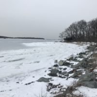
The town of Hingham is a coastal town that is about 19 miles south of Boston. It is bordered by Cohasset, Scituate, Norwell, Rockland, Weymouth, and Hull. Much of Hingham's geography is defined by water in one way or another. Hingham harbor is connected to Hingham Bay which is also known as Boston Harbor. The Weir River acts at the town line between Hingham and Hull. The Weymouth Back River represents part of the Weymouth border.
The town also has several forests and parks. Wompatuck State Park is the largest and spreads into neighboring towns (Cohasset, Scituate and Norwell). Unlike many other South Shore communities, Hingham is unique with its location to Boston Harbor and its ability to offer those conservation areas - many of which are actually islands (Bumpkin Island, Button Island, Langlee Island, Ragged Island, Sarah Island). World's End Reservation is perhaps one of the most popular sites to visit in town for its breathtaking views of the Boston skyline.
Total Area: 26.3 sq. miles
Land Area: 22.2 miles
Population: 22,157
Density: 998 per sq. mile
(source: Hingham Wikipedia Page)
The Hingham Conservation Commission is responsible for the protection and management of Hingham's Conservation land (~1000 acres) and for the administration of the Massachusetts Wetlands Protection Act and related town bylaws.
Conservation land in Hingham comes from many sources including: (1) Town resources, (2) The Trustees of the Reservation and (3) Boston Harbor Island Recreation. For each trail included in our database, we've listed the agency responsible for maintaining and preserving the resource.
(source: Hingham Conservation Commission)
The town of Hingham was initially known as "Bare Cove" by the first English settlers in 1633. The name was changed to Hingham after an English countryside town in 1635. The land on which Hingham was settled was deeded to the English by the Wampanoag sachem Wompatuck in 1655. Hingham occupied the land for nearly three decades before negotiating the purchase from the local Wampanoag tribe. An early town clerk, Daniel Cushing, kept meticulous records that have enabled current town historians to reconstruct much of Hingham's early history. He also recorded town gossip ... so that can be entertaining to look back on. According to the Historical Society, Hingham boasts one of the country’s largest collections of surviving antique homes–many dating back to the 17th century, built by the town’s founding families.
Unlike other coastal towns, the shallow harbor prohibited Hingham being a major player in the shipping routes. The Historical Society notes that the town "does have a rich if somewhat humble, industrial past – most notably cordage (ship rope and rigging) and coopering (barrels and buckets). In fact, Hingham earned the somewhat dubious designation of “bucket town,” and, although it may have been derogatory, authentic “Hingham Buckets” have become highly prized by collectors." During WWII, the Hingham Shipyard built hundreds of vessels in under four years.
(source: Hingham Wikipedia Page, Hingham Historical Society)